Tips for Students & Teachers: Analyzing Map Resources
Google Earth
Travel anywhere on the globe using Google Earth. With street views, 3D trees, historical imagery, navigation, drawing and measuring, placemarks, and tours, the options of using Google Earth in the classroom are endless. There are also the options of exploring Mars, the Moons, and sky.
Google Earth Tour Builder
Learning about the the Silk Road, Allied troop movements during WWII, or the flight of Amelia Earhart? Whatever it may be, create an outstanding visual of a journey using Google Earth Tour Builder! With the option of adding paths, photograhs, different views, and texts, students will learn about the world by taking virtual tours.
https://tourbuilder.withgoogle.com/
Mapmaker Interactive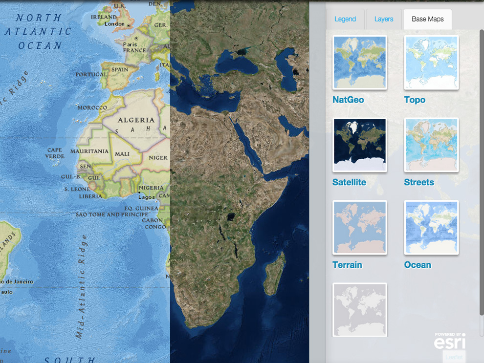
Mapmaker Interactive is a branch of National Geographic Education that allows people to customize and interact with maps of the world. Whether you are focusing on physical systems such as water, land, or climate, or human systems like populations and cultures or politcis and economics, Mapmaker Interactive allows you to single out and display these on maps. There are also the option of drawing, measuring, and pinning.
https://mapmaker.nationalgeographic.org/
TimeMaps
TimeMaps is a comprehensive interactive history atlas of the world. It is a great classroom tool that allows students to visit any civilization, nation, or empire in the history of the world and see the context, chronology, connections, and big pictures of history. With the inclusion of layers of information, timelines, images, animations and worksheets, TimeMaps shows complex interactions and internal dynamics. Its also just a fun, visually stimulating way for students to see the world's civilizations and how they changed over time.
Seth Dixon's Scoop.it
Scoop.it is a website community where people can share their interests and ideas. Seth Dixon, a geography professor at Rhode Island College, uses Scoop.it to share helpful geography educational resources. He covers a variety of topics, including fantastic maps. He provides an interesting and very unique grouping of different kinds of maps, from "The Earth in Reverse" to how U.S. states' GDPs compare to countries around the world. Seth Dixon's Scoop.it is an excellent way to get ideas and to think outside of the box when it comes to using maps in the classroom.
http://www.scoop.it/t/fantastic-maps
National Geographic Atlas Puzzles
If you are looking for a fun way to challenge your students' geography skills and see if they know where things fit in the world, try out National Geographic's online atlas puzzles! Students have the option of choosing from over 20 maps to piece back together, all based off of National Geographic's world renown cartography. This fun and challenging geographic activitiy will test student's knowledge about the world and/or help them visualize where things are on the globe.
http://maps.nationalgeographic.com/maps/atlas/puzzles.html
Digital History
Digital History is a compilation of maps from throughout history, including 15-19th centuries, the Revolutionary Era, the Early National Period, and the Civil War. For some of these map eras, there are over 20 map resources, providing teachers with lots of variety when teaching about the world and how civilations mapped it through time. Digital History also provides other helpful teacher map resources, such as Maps as Teaching Tools, Maps by Topic, and Maps by State, Territory, Region, and City.
http://www.digitalhistory.uh.edu/maps/maps.cfm#15c
Exploration of North America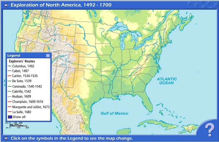
This map shows the routes of early European explorers who came to North America. Students can choose from an interactive legend which exploration routes they would like to see and how long each route took. There is also the option of displaying more than one route at a time to compare various journeys. This map is particularly good at showing how early explorers traversed the new and diverse American geographic landscape. The map also provides activities and a "Learn More About It" section to go along with the exploration routes.
http://eduplace.com/kids/socsci/books/applications/imaps/maps/g5s_u2/
U.S. Census Maps & Data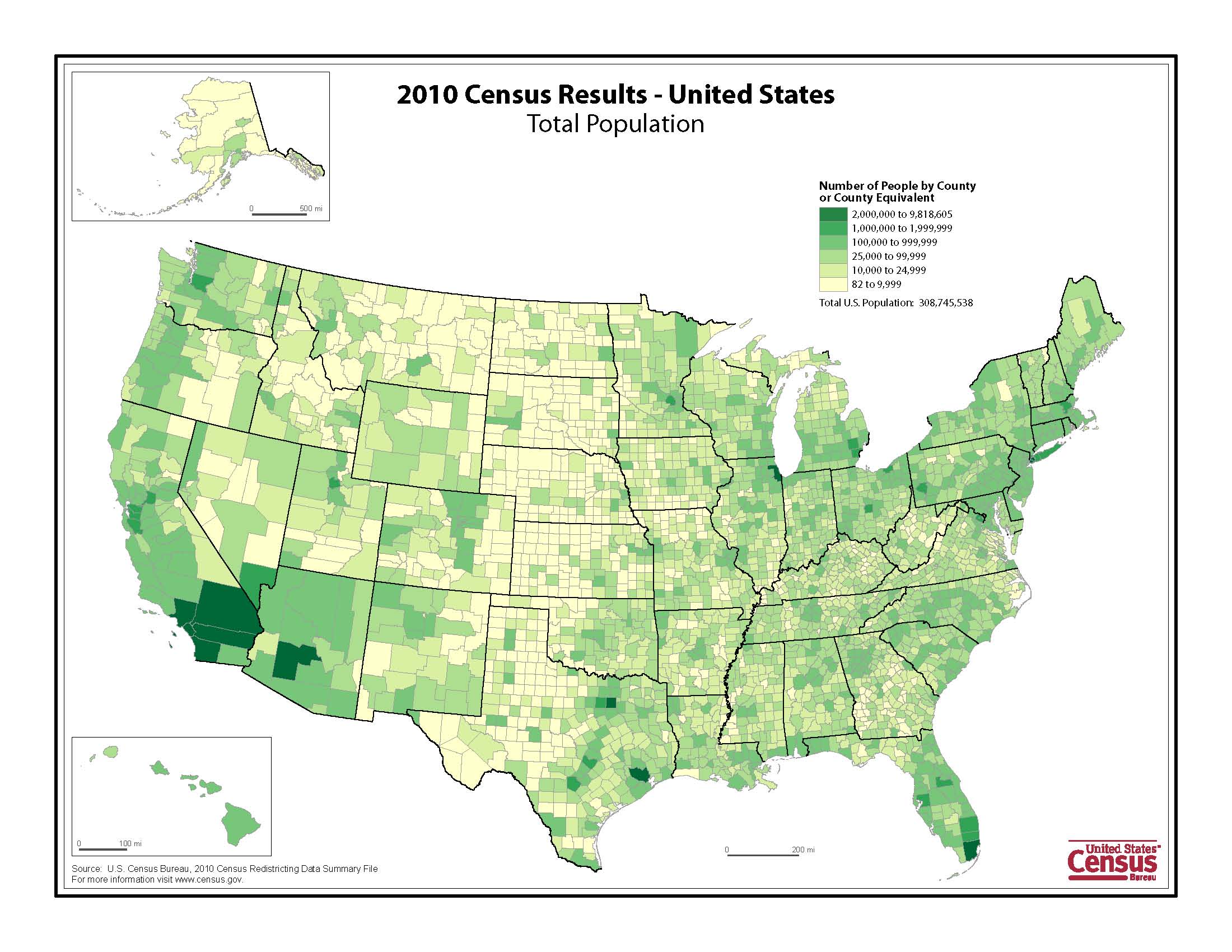
The U.S. Department of Commerce provides geographic data and maps, including a census data mapper, reference and thematic maps, and statistical data tools. Whether you are looking for maps of U.S. agriculture, race/ethnicity, natural disasters, urban areas, etc. you will find it here. The possibilities for classroom resources and references are endless.
http://www.census.gov/geo/maps-data/index.html
Arizona Geographic Alliance: Maps
The Arizona Geographic Alliance provides an entire page on their website dedicated to free downloadable maps. With over 200 outline and thematic maps to choose from, teachers have great world, regional, country, U.S., and historical maps at their disposal to be used in the classroom.


